
The High Mountains of Lebanon
Fragile landscapes under mounting pressure
Lebanon's high mountains form the country's ecological backbone. Embedded into local culture. Underpinning community livelihoods. These breathtaking landscapes harbor vital water resources, support diverse ecosystems, and anchor rural communities that have shaped the terrain for centuries. Yet satellite imagery from 1998 to 2017 revealed alarming changes in vegetation and snow cover, clear indicators of an increasingly fragile and degraded environment.

Urban sprawl is expanding upward from coastal cities, while unfettered tourism strips hillsides bare and illegal quarrying scars the slopes. Climate change, meanwhile, continues to significantly impact snowfall patterns that mountain communities have relied on for agriculture and water supply for millennia. Previous regulatory efforts were impeded by fragmented geospatial data and inconsistent enforcement, not to mention the absence of a comprehensive, cross-sectoral vision able to align environmental protection with community needs.
Protecting the mountains of Lebanon involves more than mere regulation. It demands integrated planning capable of guiding regional development while at the same time restoring these degraded landscapes. UNDP appointed ORG to develop masterplans that would transform an entire nation’s approach to mountain management.


A data-rich, interdisciplinary approach
The project bridged technical analysis with extensive community engagement to develop a layered understanding of Lebanon's mountain landscapes. From remote sensing to field surveys to GIS modeling, the team brought together urban, environmental, agricultural, geological and socioeconomic data into a comprehensive spatial framework.


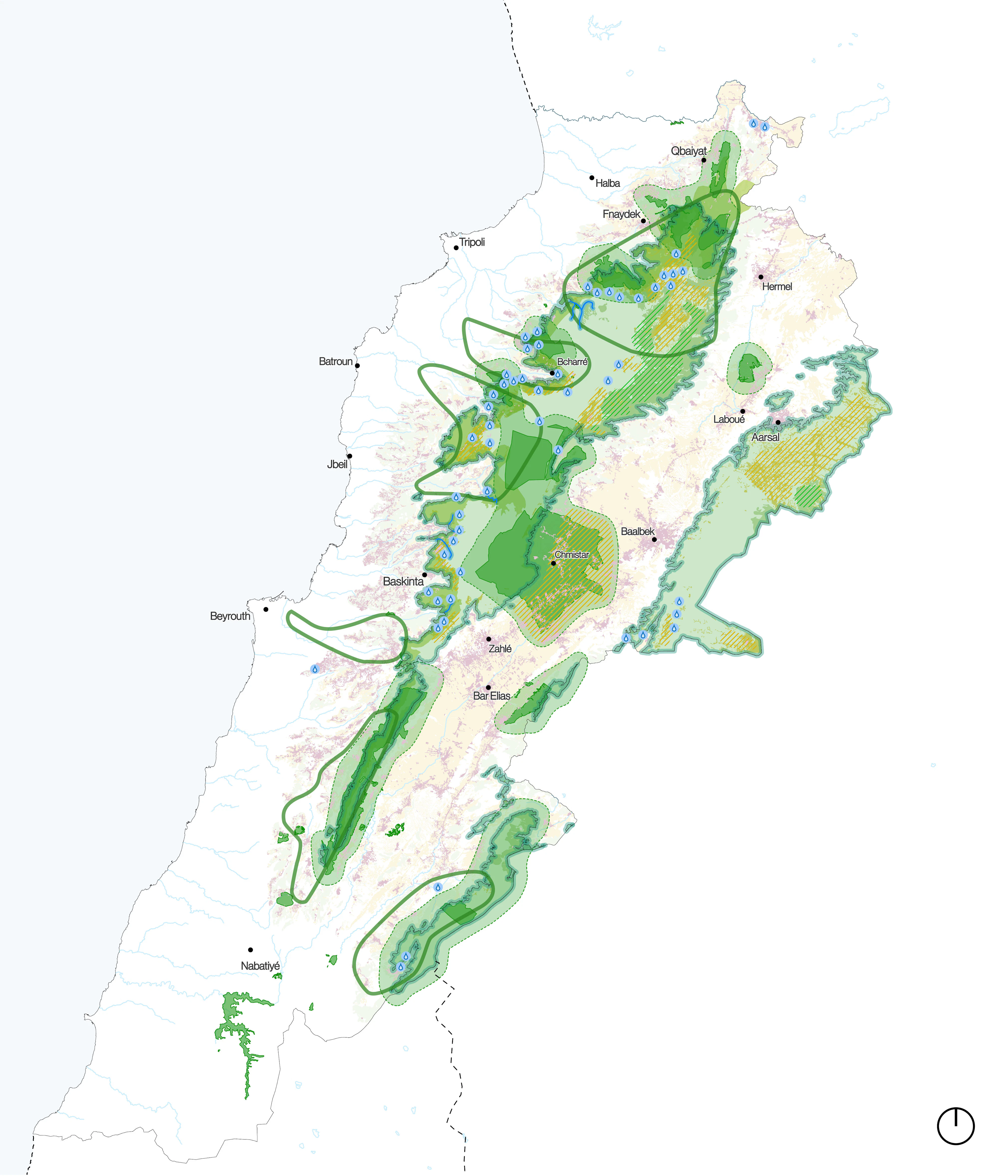
Using NDVI (Normalized Difference Vegetation Index) and NDSI (Normalized Difference Snow Index) sensing indices, the team mapped changes in vegetation and snow cover to analyze land change patterns and identify zones of severe degradation. These areas were then designated to include ecological corridors, reforestation targets, and water retention zones to capture the runoff from melting snow.

Stakeholder engagement across municipalities, environmental groups and local communities also helped to ensure the final master plans reflected both ecological imperatives and community aspirations.


The process generated deliverables spanning both national and local scales. These include master plans for areas 800m above sea level in Jbeil and Akkar, two governorates in the northern part of the country, updates to zoning documentation, and localized action plans.


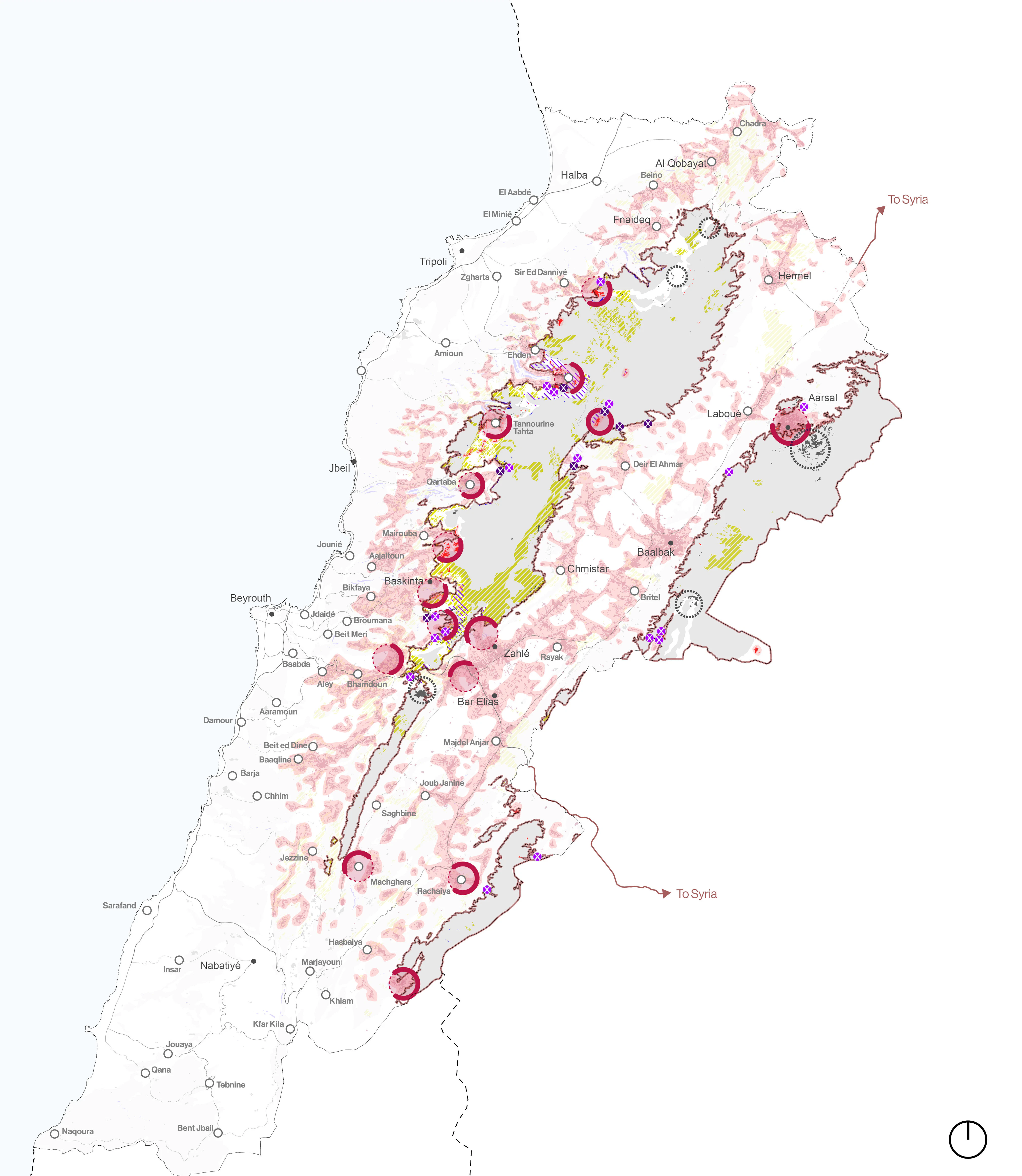
All are underpinned by a GIS database housed at the country’s Ministry of Environment, supporting effective cross-ministerial coordination and policy alignment in the future.


Bringing the ecology and the economy into balance
The master plans propose ecological corridors that function as the landscape's circulatory system.
Water corridors channel snowmelt into retention zones, preventing erosion while storing resources for dry seasons. Green corridors, meanwhile, connect fragmented habitats, protect biodiversity and support reforestation across elevation zones. These blue and green corridors work together to rebuild landscape resilience.
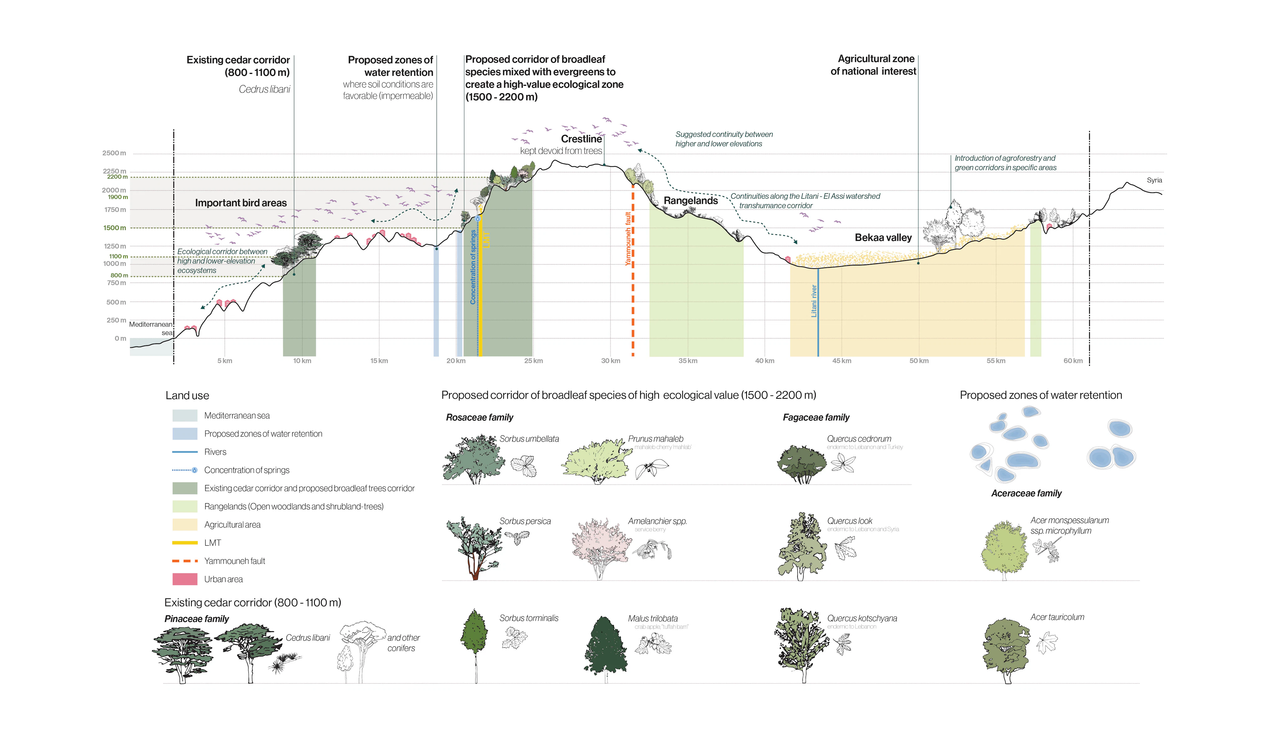
At the same time, sustainable and nature-based practices support local economic development in Akkar and Jbeil. Providing social and infrastructural amenities and services, while simultaneously drawing up development strategies to underpin agro-industry, nature-based tourism and cultural heritage, will ensure that conservation and economic opportunity progress in harmony.
