North C Neutral
Navigating one of the world's most contested waters
The North Sea is one of the most crowded marine environments on the planet. Offshore wind turbines rise from the same waters fishing boats have worked for generations. Shipping lanes carve through zones marked for sand extraction. Nature reserves are located next to defense training grounds. Telecommunications cables snake past gas wells and potential CO2 storage sites, while scientific research stations, tourism operators, and aquaculture farms stake their claims on what little space remains.
The result is conflicting interests, competing claims, security-critical uses and mounting pressure even as European sustainability deadlines draw closer.

Traditional marine planning has tackled overcrowding one sector at a time, optimizing individual uses while neglecting spatial and systemic interactions between uses. This has led to inefficiencies, missed synergies and stakeholder conflict.
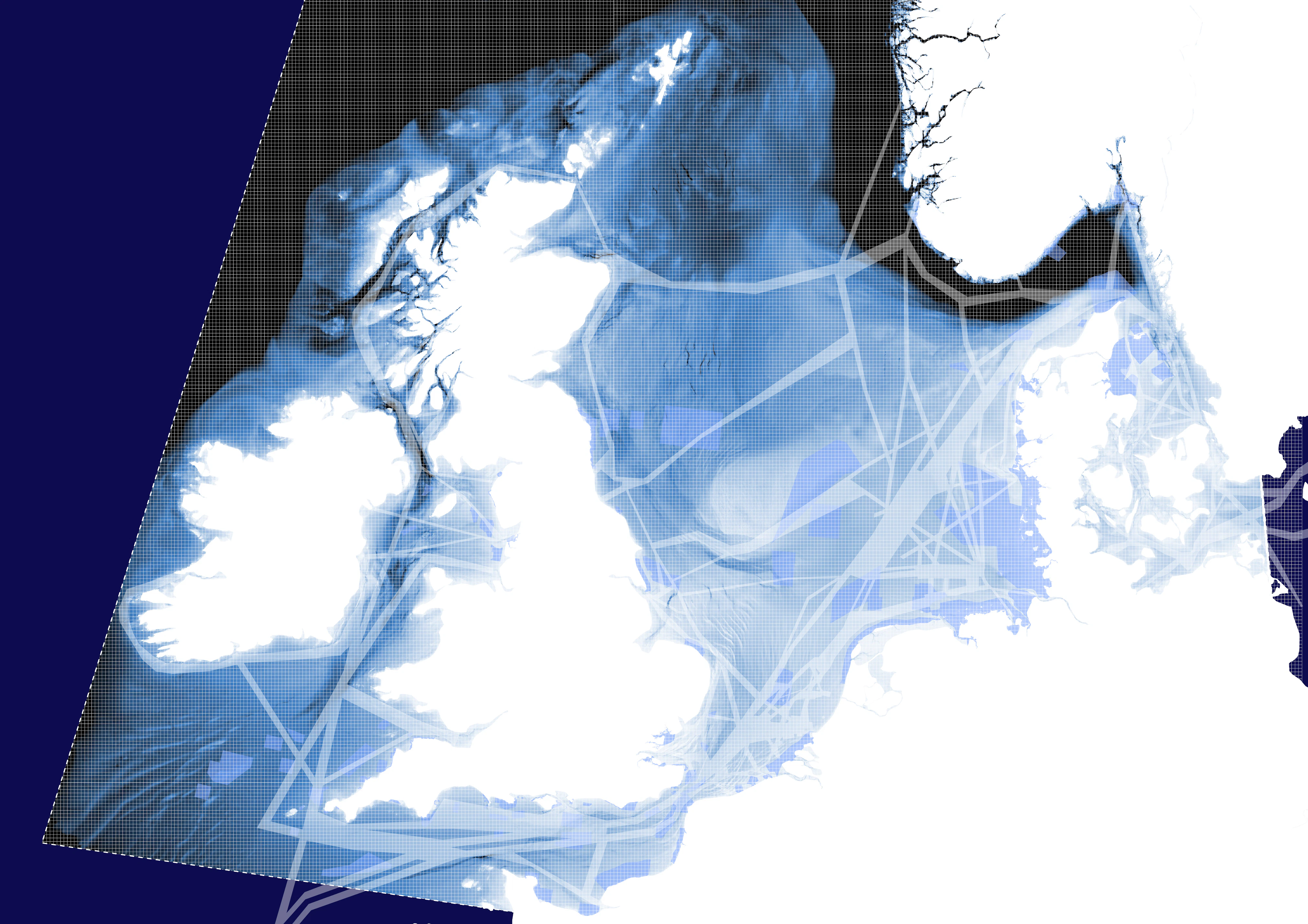
Meanwhile, the North Sea knows no borders. Wind farms cause wake effects that drift into neighboring waters, fish populations migrate across jurisdictions, and ecological systems flow freely between countries. Yet marine spatial plans are still drawn up from a national perspective, without taking into account the continuity of the North Sea basin.
In the background, countries are preparing for exponential growth in offshore energy production. The need for predictive tools to simulate future development scenarios, assess cumulative spatial impacts, and guide investment decisions has become more urgent than ever. In that context, North C Neutral could enable economies of scale, support more efficient cabling strategies, optimise the use of harbour infrastructure, and reduce distances between offshore assets and ports.
Charting a common course through data and dialogue
North C Neutral combines quantitative modeling with collaborative scenario development to create marine spatial strategies that are both technically sound and politically achievable.
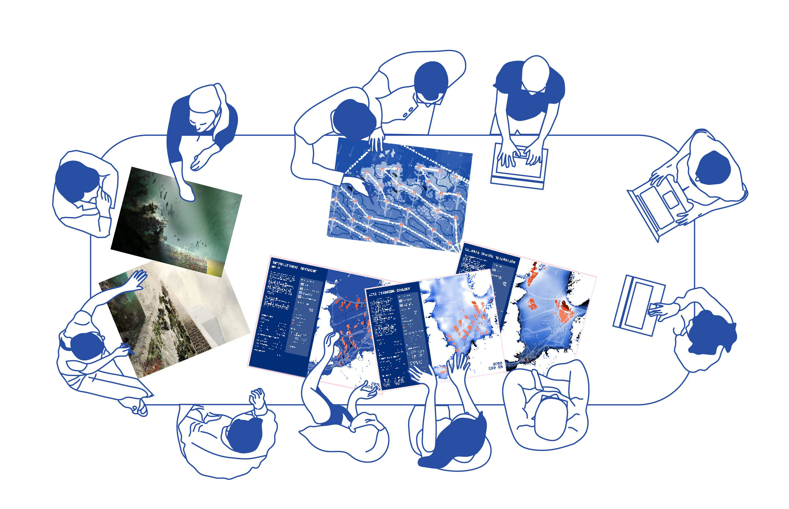
At its core sits the North C Neutralizer: a computational model that calculates optimized spatial layouts across multiple stakeholder scenarios. The tool balances energy output, economic cost, CO2 emissions, climate and ecological impact, and spatial feasibility against competing demands. It produces future-oriented roadmaps, showing how different sea use profiles can coexist, each layout representing a distinct answer to the question of how this crowded basin can function over time.

The Neutralizer doesn't operate in isolation but is embedded in the wider North C Neutral methodology, which brings together spatial designers, experts and policymakers to shape integrated masterplans on a basin scale. Scenarios are tested for resilience under changing conditions, selected with the lowest overall CO2footprint, evaluated for cost-efficiency across multiple sectors, and measured against biodiversity and other targets.
This process ensures that plans don't just work in theory but hold up against real-world pressures while advancing goals that stakeholders actually share.

Mapping pathways to a shared sea
Stakeholders are free to adjust input parameters such as cooperation levels, emission impact and investment timelines, then watch as the model generates unique layout plans in response. The interface unites spatial, technical and economic data in a single decision-making dashboard that transforms abstract trade-offs into concrete maps and figures. Instead of competing in silo, energy companies, policymakers and environmental organizations can now gather around the same visualization and find common ground.
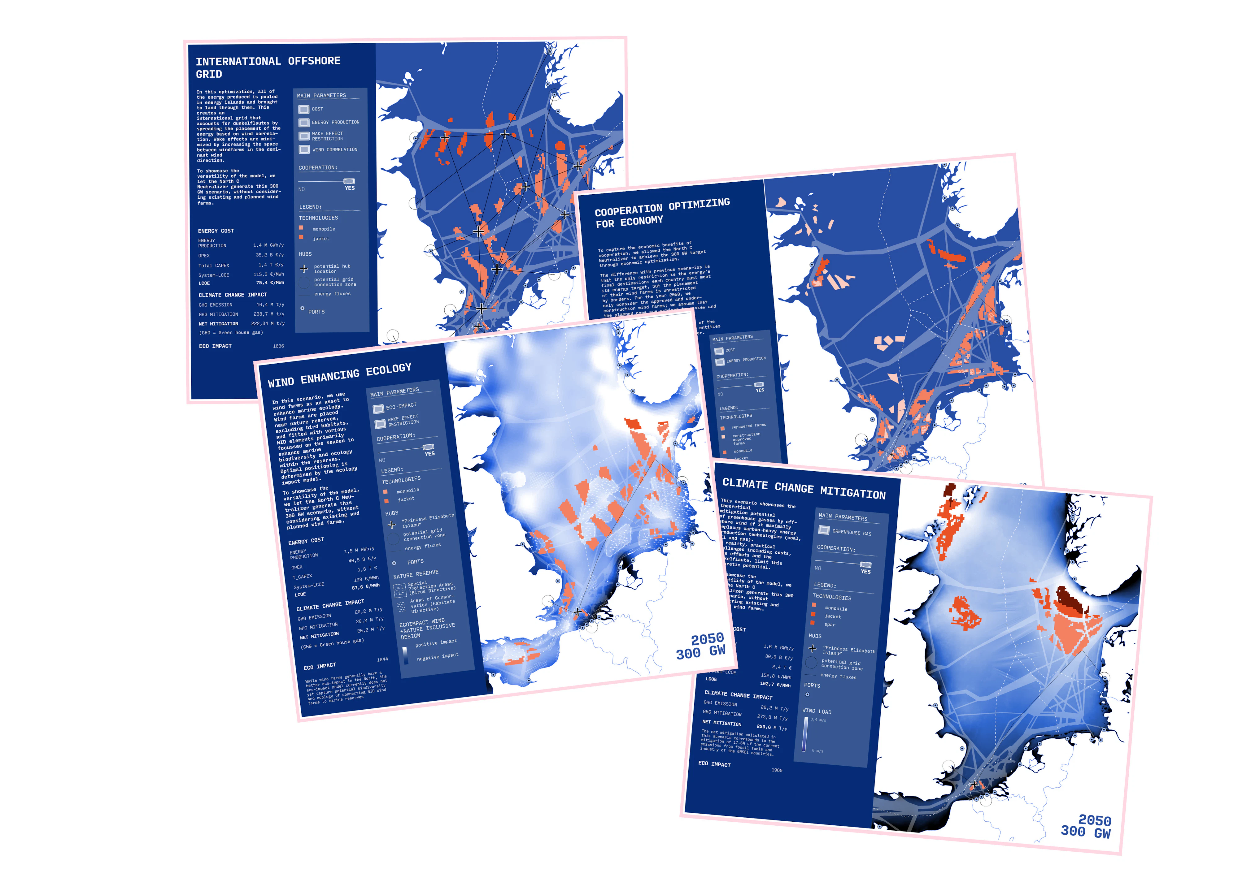


The North C Neutralizer delivers coordinated development pathways spanning energy, aquaculture, fisheries, ecology, military operations and more. In doing so, it enables countries to meet their targets while minimizing spatial conflict, transforming a crowded sea into a choreographed space.
The model simulates energy transitions at X-year intervals from 2028 to 2050, projecting wind capacity growth from 28 GW to 300 GW. Each roadmap adapts to economic constraints, marine spatial realities and environmental constraints, providing basin-scale alignment toward net-zero targets that individual countries struggle to coordinate alone.


The outcome is a shared, optimized spatial plan that balances competing interests while keeping the North Sea not only healthy, but also profitable and genuinely future-proof. And no: the name is not a coincidence. Presented to the Greater North Sea Basin Initiative and European sea basin platforms, the tool stands for a united ambition to make the North Sea both carbon-neutral and conflict-neutral.

With marine spaces from the South China Sea to the Gulf of Mexico facing similar pressures, North C Neutral offers a replicable model able to adapt to any sea basin. As one collaborator noted: "it is just a matter of changing the input data,” as part of an approach where the complexity of competing demands meets the clarity of computational design.