New Meadowlands featured in The Guardian
Publication
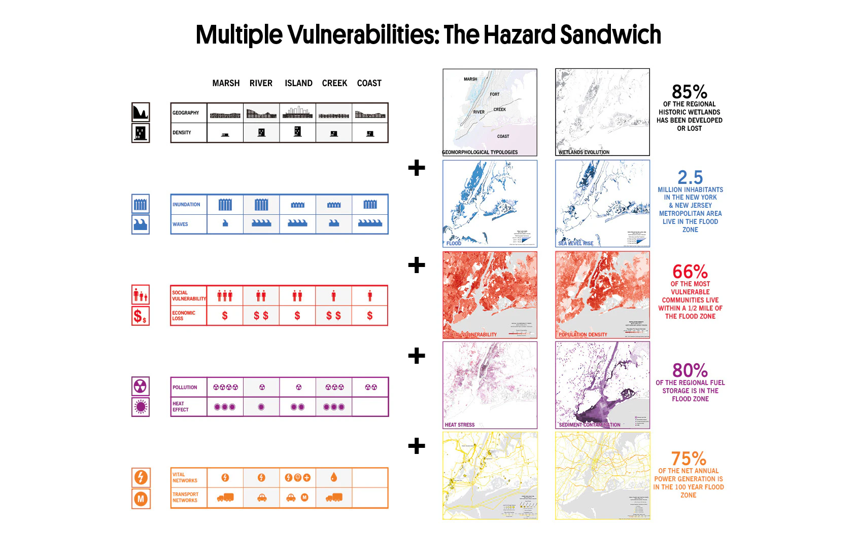
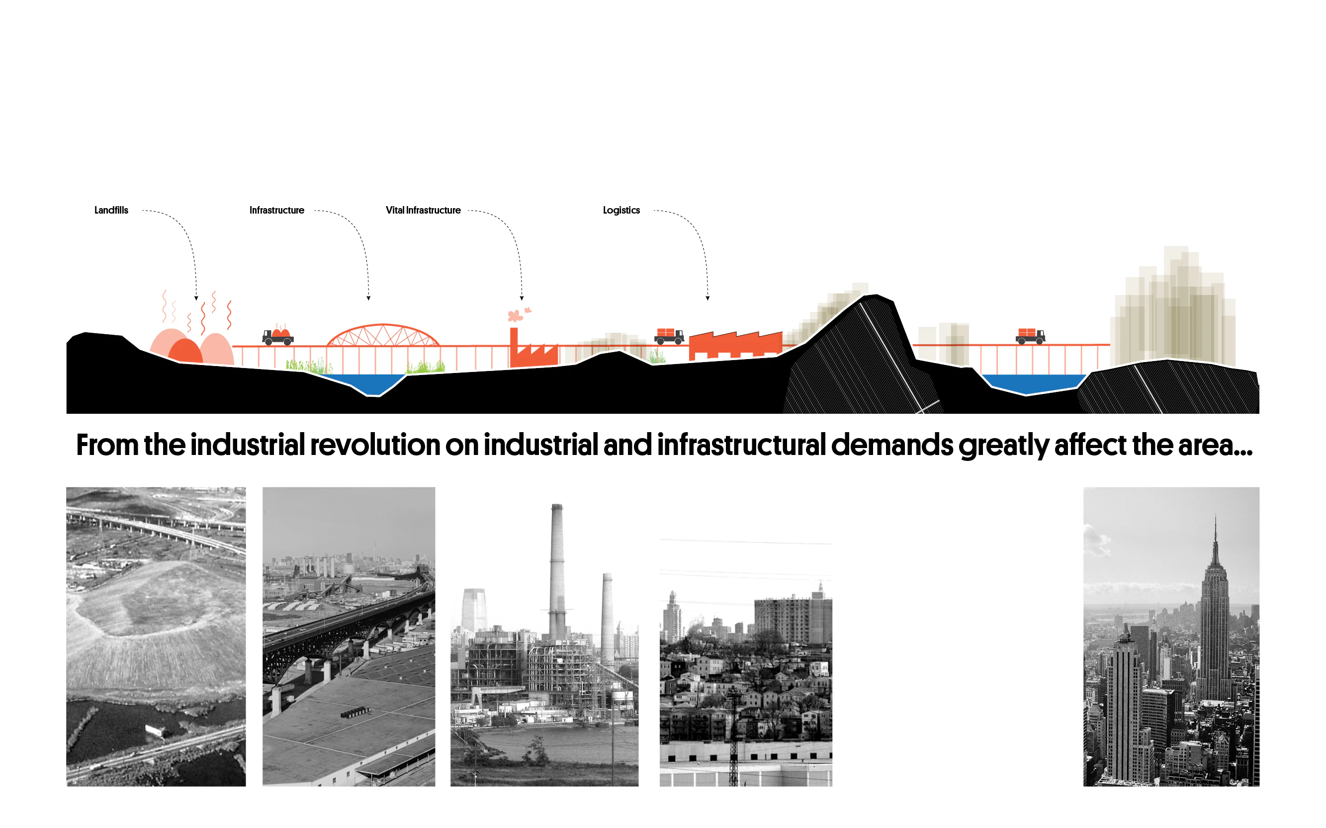
The Meadowlands basin sprawls across northern New Jersey as a patchwork of marshes, highways, industrial zones and low-income communities. A vulnerability to chronic and acute flooding had been exacerbated by increasing environmental degradation and hazards.
This vulnerability overlapped with a series of compounding risks, from legacy pollution to aging infrastructure and social inequality. At the same time, many municipalities lacked the capacity to plan or fund climate-adaptive infrastructure. And then in 2012, Hurricane Sandy hit.
The hurricane left chaos in its wake. The scale of the damage demanded a regional response that could also engage local communities, lead to place-specific implementation, enhance resilience and improve social cohesion.
Together with ZUS and De Urbanisten, a multidisciplinary team from MIT CAU won federal support for a regional flood resilience plan. Their vision was then translated into a phased implementation managed by NJDEP and focused on communities including Teterboro, Carlstadt, Little Ferry, Moonachie, and South Hackensack.

The shift from a conceptual competition plan to federally funded public works presented a significant challenge. Risk-based phasing, infrastructure sequencing, and interagency alignment all had to come together – yet all without losing ambition. The design also had to meet strict regulatory, engineering, and maintenance criteria while retaining social and ecological vision.


The project team conducted a comprehensive spatial diagnosis across the entire basin. Using a GIS framework, the team mapped both cumulative exposure (storm surge, rain, pollution and infrastructure dependence) and social vulnerabilities.
The resulting analysis revealed patterns invisible to single-issue approaches, guiding the selection of three pilot test sites where investments would deliver the greatest impact. This data-driven approach helped to generate tools that enable both regional thinking and local activation.
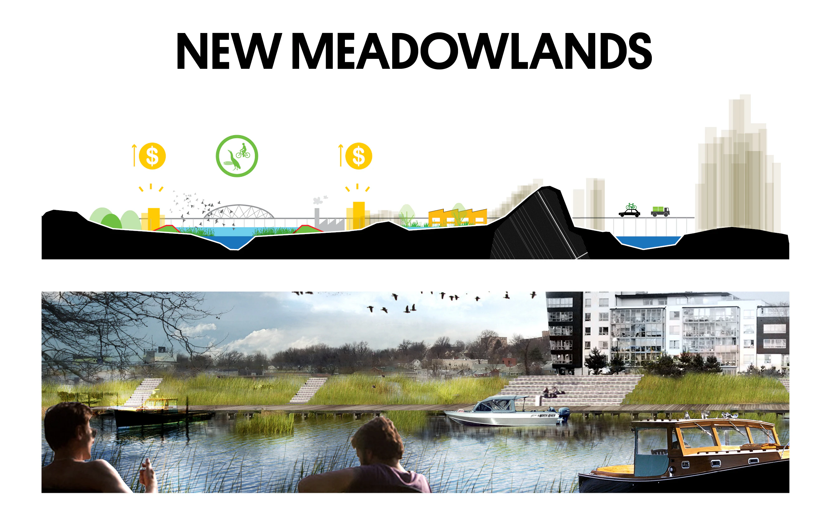
A co-creation process based on intense collaboration with locals and stakeholders also helped to inform the resilience master plan shaped by a three-part Protect / Connect / Grow approach:

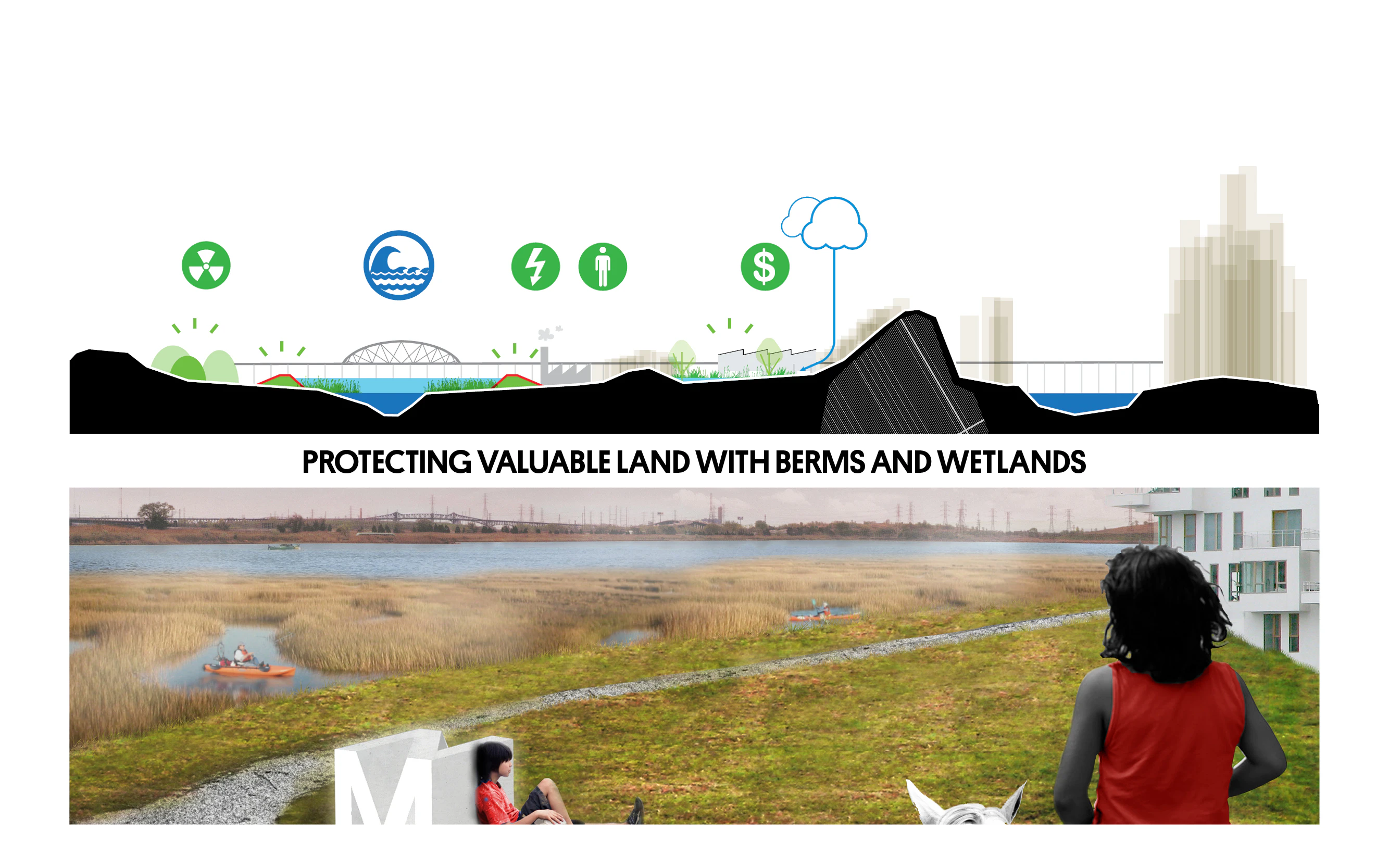
Communities are protected through berms, floodwalls, and stormwater infrastructure. They're connected via a new "Meadowband" of civic infrastructure and utility networks. And they grow opportunities through strategic redevelopment of disused land and intensification of adjacent areas.
These strategies were translated into local implementation roadmaps, creating clear pathways for municipal action and funding alignment.

The project advances a model for climate adaptation that simultaneously incorporates infrastructure, ecology and civic space. In doing so, it transforms risk-prone territories into resilient, productive, liveable environments.
Running along the basin’s edge, the Meadowland integrates berms, flood walls, utilities and mobility infrastructure with parks, social amenities and development zones. Rather than simply defending against water, it acts as both a protection line and a community asset: a multifunctional civic infrastructure where safety measures enhance daily life.


Within the basin's flood zones, the Meadowpark strategy aims to restore wetlands while introducing flexible green areas that absorb water, allow biodiversity to flourish, and support recreation. These spaces function as flood buffers during storms and as community assets during dry periods, proving that resilience and liveability can work seamlessly together.
The project demonstrates the potential of climate adaptation as a catalyst for regional-scale transformation. By treating flood risk as a design opportunity rather than just an engineering problem, we create infrastructure that strengthens communities both environmentally and socially.
ORG supported the AECOM-led team in the implementation of phase one of the masterplan. The project combines storm surge barriers alignment design for the long term, water conveyance and pump infrastructure; green infrastructure embedded in quality public space; and strategic redevelopment that delivers both climate safety and long-term spatial transformation.