
Public Space Manual's website
Website
Designing public space means navigating a maze of competing demands. Streets and squares must accommodate mobility flows, take into account of climate resilience, economic activity, heritage preservation, and community life – often within highly constrained footprints where every square meter matters.
The institutional landscape that governs the design of these spaces is fragmented across numerous agencies, conflicting policy layers and evolving spatial demands, making it difficult to implement consistent, future-proof standards across the city’s 161 km² territory.
Previous attempts to coordinate public space development were hampered by scattered guidance documents, inconsistent application of norms and the absence of a unified vision that could bridge regulatory requirements with design ambition.
The Brussels-Capital Region recognized that improving public space quality would require more than new rules. It demanded an integrated planning instrument that could synthesize existing knowledge while offering tailored, site-specific guidance to practitioners on the ground.
ORG approached the Manual as both a technical challenge and a diplomatic exercise integrating advanced analytics and participatory design.
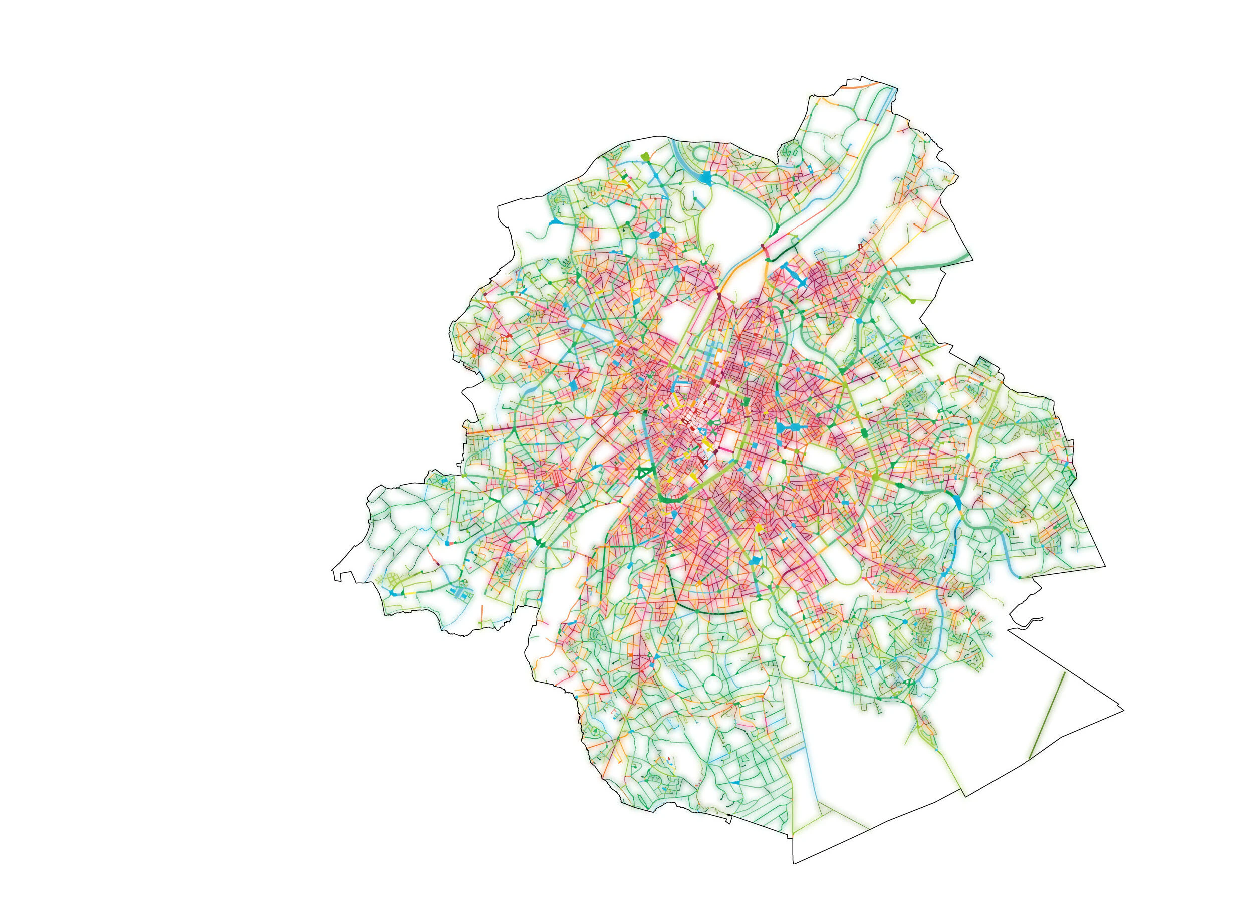
The process centered on a custom-built GIS database to automatically classify and map public space segments across the city based on their geometric properties.
This allowed the team to harness the power of existing and extensive datasets that cover everything from mobility patterns to environmental conditions, then translate them into actionable design strategies and recommendations based on size, function, location and context.
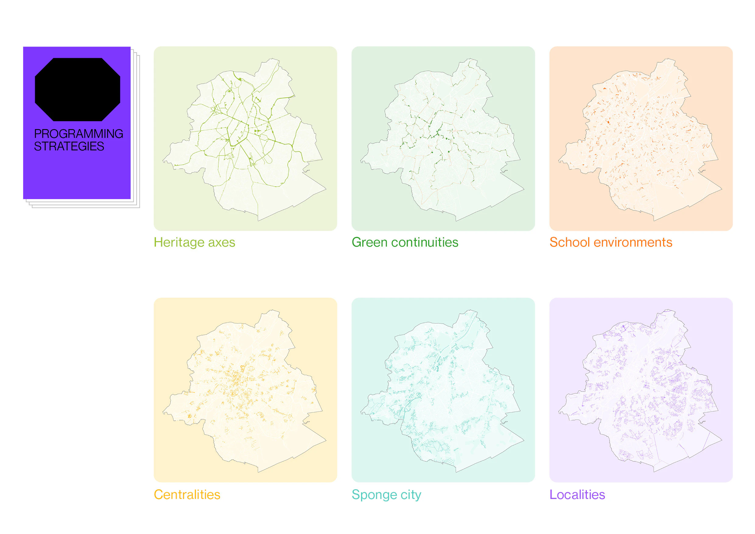

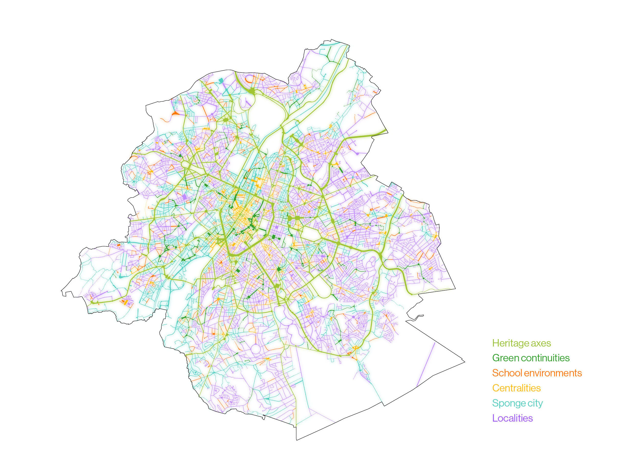
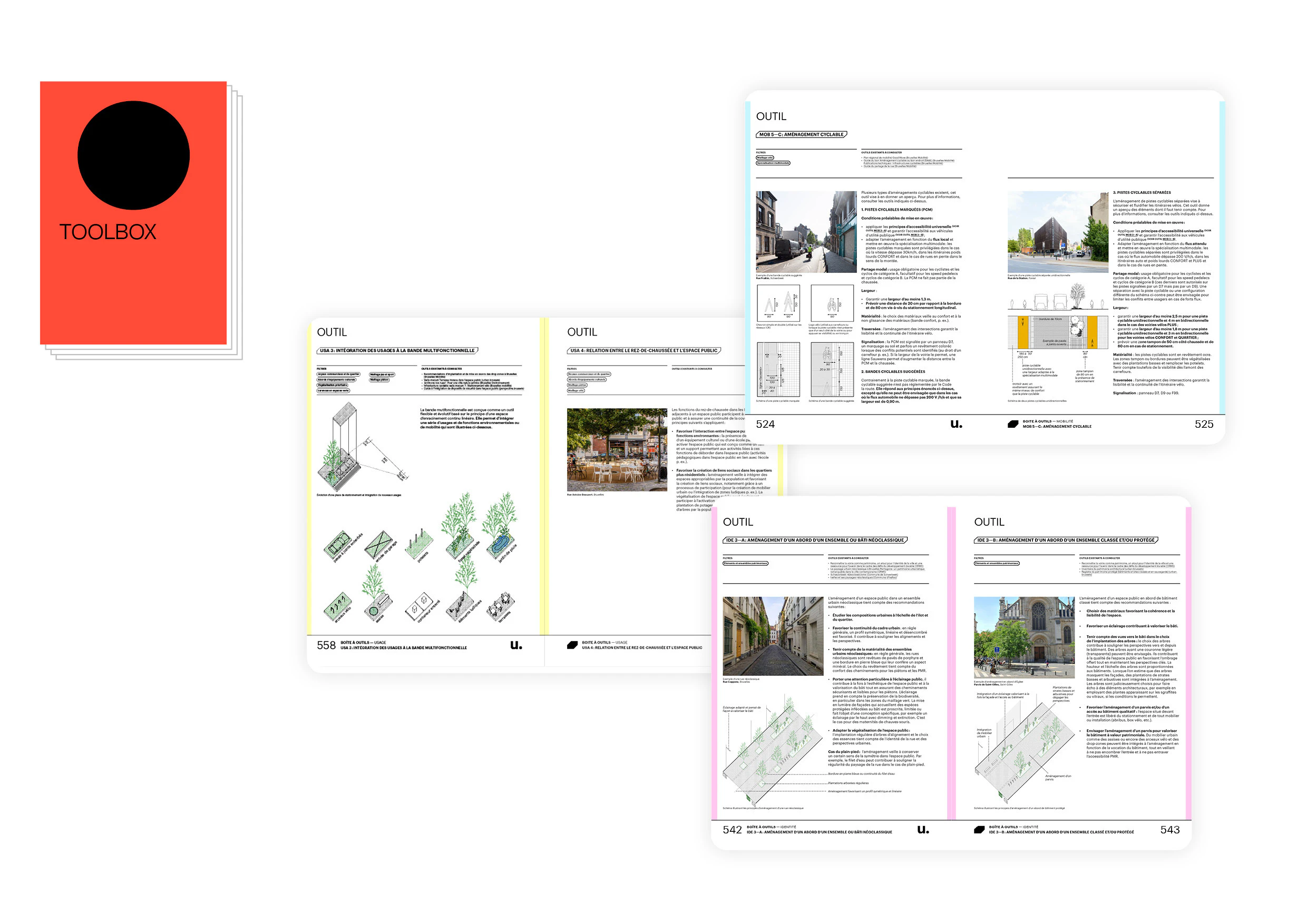
An intensive stakeholder process allowed the team to prioritize space allocation across five interdependent themes: Environment, Materiality, Use, Mobility and Identity. The working sessions also helped to shape six core programming strategies that could be adapted into concrete and size-dependent spatial strategies as well as user-friendly planning tools.


Our methodology bridged data precision with community insight, ensuring that the final framework reflected both technical requirements and local priorities. Rather than imposing top-down solutions, the process generated a flexible toolkit that could respond to the specific conditions of any given site while maintaining coherence across the broader urban fabric.
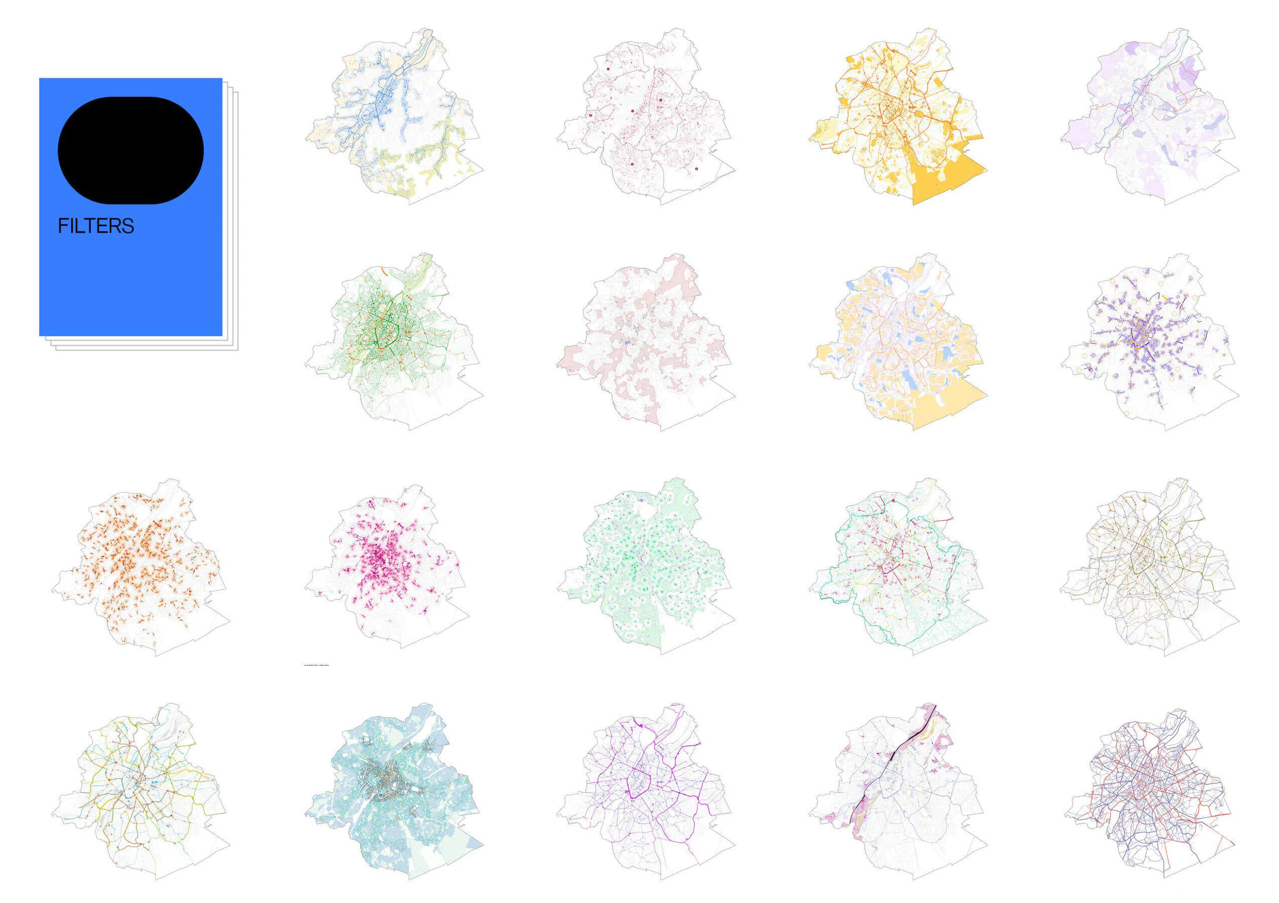
Spatially grounded, policy-aligned and adaptable to specific project sites, the Public Space Manual operates as both as an analytical tool and a citywide planning instrument, offering location-specific recommendations through an intuitive web platform.
The GIS platform allows users to select any public space and access detailed programming strategies, technical specifications, section diagrams and case studies tailored to that specific site's unique characteristics and challenges.
The Manual's five themes each bring a distinct focus to spatial quality, ensuring that every intervention contributes to spatial quality, climate resilience and urban identity. By organizing recommendations around these themes, the tool helps practitioners to navigate trade-offs while maintaining strong ambitions across all aspects of public space design.
Since its launch in 2024, the Manual has established a new standard for public space planning in Brussels, providing municipalities and designers with the clarity and confidence they need to implement high-quality interventions.

More than a static document, the Brussels Public Space Manual represents a shift toward adaptive, evidence-based planning that can respond to changing urban conditions while upholding consistent quality standards.

